FINALLY !!!
THE FIRST INTERNATIONAL XT 500 MEETING


Where? Salbertrand, Italien (Piemonte, Susa-Tal), Camp "Grand Bosco"
When? Wednesday July 17, 2002 to Wednesday July 24, 2002
(Main event: Friday, Saturday, Sunday)
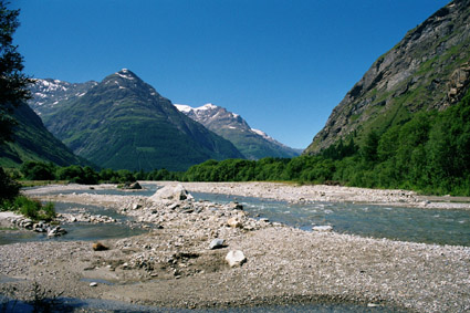
Get ready for the unique, first time ever XT 500 meeting to be held at 3.090 feet (1.035 meters) above sea level. Maximum diversity of enduro off-road tracks of varying difficulty in alpine surroundings. Ride dust and dirt tracks til you drop!!!
The tracks go up approximately 9.000 feet (3.000 m). They are mostly old military tracks from World War II trailing along the Italian-French border.
Culturally Briancon France is nearby, a small mideval town in the center of which is a castle. Turino, Italy, is also in close vicinity. A summer sledding track is located in nearby Claviere, and in the town of Exilles you can find a 19th century castle which is also a museum. In addition the monestery Sacra di San Michele is nearby which is similar to the monestery Mont St. Michlele in Normandy.
The climate is Mediterranean, but depending on the altitude rather fresh!! Amazing nightly skies, few insects, few trucks, but LOTS OF MOTORCYCLES.
The nearest gas station, restaurant and supermarket is 1.4 miles (3 km) from the campground. On the campground is a small bar, a mini market, soccer fields, basketball and volleyball courts.
Currently (in 2001) the price per night is 11 Euro per person with a tent and a bike. This includes a warm shower. The meeting will occur before the summer holidays in Italy therefore the campground will be rather empty. The campground owners, however, insist on the right to evict all hooligans or anyone being too loud. By the way, the sanitary facilities are brand new and super clean!
KEDO, a German supplier for XT 500 parts will supply commission parts, just in case. (Thanks to Daniel).
Offroad tracks: Assietta kammstrasse, Colle Sommeiller, Col de Bousson and Lago nero, mont Jafferau, Col de Granon, Col de Valbelle, Col de Parpaillon, and others around the Lake of Mont Cenis.
Books: Enduro-Atlas Band 1, ISBN3-908007-44-5, Grosser Alpen Strassenführer Denzel, ISBN 3-85047-748-7.
Maps: Michelin 428 (to get there), Michelin 244, instituto Geofrafico Centrale: No 1 Valli di Susa 1:50.000 Erwerb y.B.bei: www.drgoetze.it
Web: www.campinggranbosco.it, www.piemonte.it, www.discoveritalia.de
Suggestions to get there by motorcycle - it's a great trip if the weather is good.
Lake of Geneva - Small St. Bernhard Pass - Big St Bernhard Pass - Aosta -
Col de l ‚Iseran, Monte Cenis (pass) - Susa - Salbertrand - it's about 160 miles (300 km) easy to drive in one day.
In case you're in a hurry: Take the highway till Grenoble France.
After that 150 km of country roads going through two passes.
Any questions - Contact:
Tom Zuendel, tom@tzwerbung.de, 0049 40-723 70 252 (also French)
or
Bjorn Grüsser, LSB-Telekommunikation@web.de, 0049 40-728 10 790 (also English)
UNTIL NEXT YEAR! GOODBYE, AU REVOIR, CIAO, ADIO, TSCHÜSS, ETC.
Your Björn and your XTom